
From an Anaximander Map to a Google Map,the history of cartography.
Google Maps is the first thing that will usually come to the mind of an average traveler when making a reference to a map. But have you ever wondered what ancient famous explorers like Vasco Nunez de Balboa, Christopher Columbus or Vasco da Gama used as a guide when sojourning the world as you do today ?
From here mehkury takes you on a cartographic time travel,when men explored the world without Google ....lol
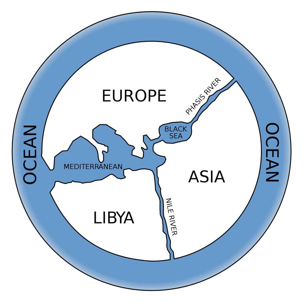
1. ANAXIMANDER WORLD MAP, 6TH CENTURY BC

(Image: Public Domain)
Anaximander was a Greek philosopher who lived in the 6th Century BC and was arguably the founder of cartography. His map is probably the first of the known world.
Anaximander’s world was very different to ours: it included only the Mediterranean Sea and three major landmasses: Europe, Asia and Libya, which represents modern-day North Africa. Most importantly, it gave future cartographers something to build on and encouraged trade, exploration and unification.
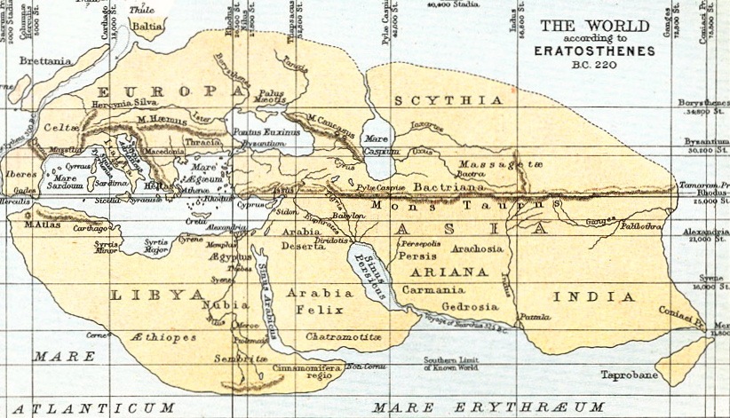
2. ERATOSTHENES’ MAP OF THE KNOWN WORLD, 194 BC
(Image: Public Domain)
Fast-forward 300 years and the “Father of Geography” was born. Eratosthenes (another Greek) developed Anaximander’s map and other pioneers’ work, advancing the map of the known world.
Eratosthenes inserted grid lines of longitude and latitude and suggested the existence of poles and equators on his maps. Four hundred cities and their locations were shown on his great work Geographika. Geography was born.
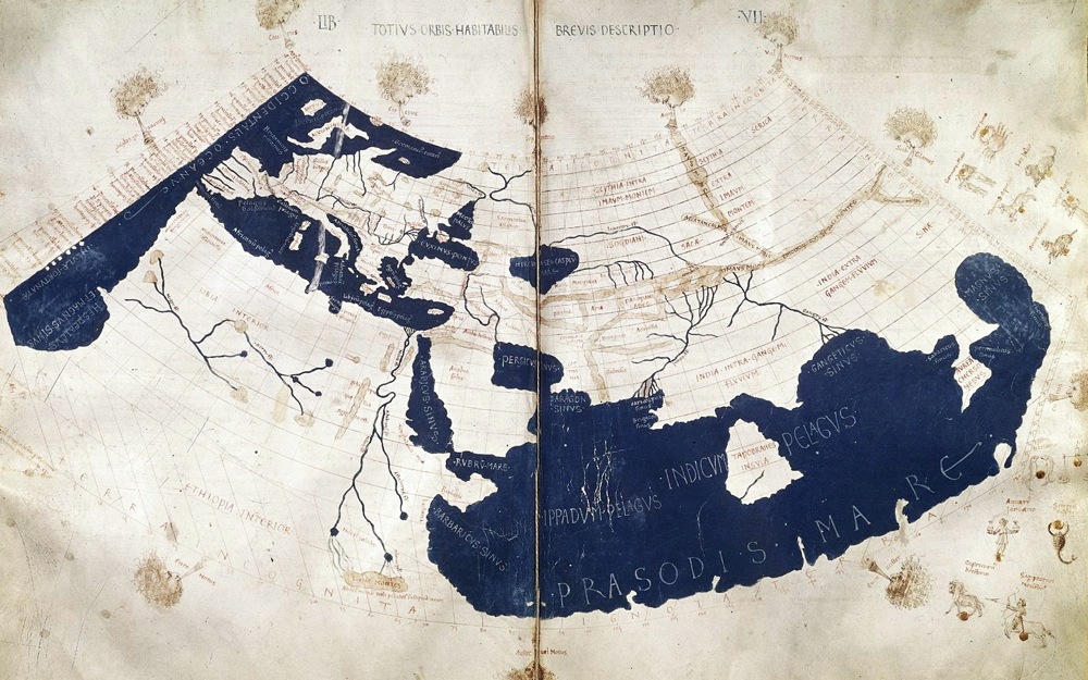
3. PTOLEMY’S WORLD MAP, CIRCA 150
(Image: Public Domain)
The Greeks pretty much had a lockout on early cartography and Ptolemy’s work only cemented this. The mathematician, astronomer, geographer and astrologer Claudius Ptolemy lived through the late first and early second century, yet his maps were still being used nearly 1,500 years later.
Ptolemy recognised that he only knew a small portion of the world despite including far wider areas of land from China in the east to the mid-Atlantic Ocean in the West. Most of Europe was mapped along with larger areas of Africa.
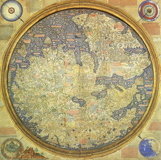
4. FRA MAURO MAP OF THE WORLD, CIRCA 1450
(Image: Public Domain)
Fra Mauro is an Italian monk and a bit of a hippie. His map is considered “the greatest memorial of medieval cartography” which is pretty special considering he drew it upside down.
Despite the inversion, the map is exceptionally accurate compared with its predecessors. It includes detailed representations of largely unmapped areas of India, Africa, China and Japan. He was also one of the first to suggest that the Indian Ocean was not closed and Africa could be circumnavigated by her southern end. Or would that be northern…
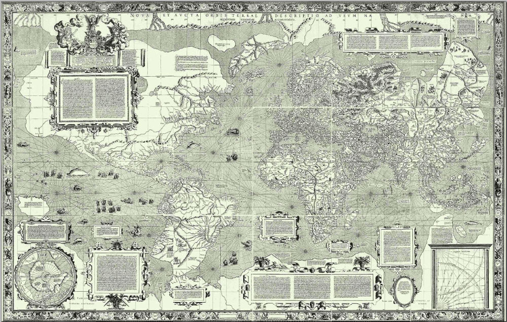
5. MERCATOR’S WORLD MAP, 1569
(Image: Public Domain)
Mercator’s map was designed for ease of navigation and to quote the man himself “to spread on a plane the surface of the sphere in such a way that the positions of places shall correspond on all sides with each other, both in so far as true direction and distance are concerned and as correct longitudes and latitudes.”
The mathematics behind Mercator Projection are sound and thus it is the most popular map projection still used and so seen today.
6. ATLAS MAIOR, 1634
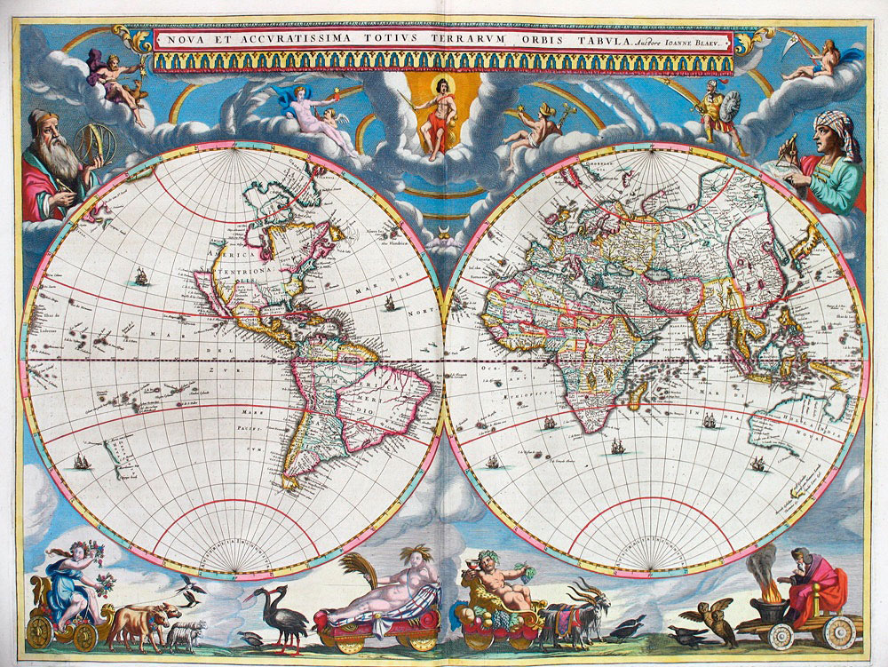
(Image: Public Domain)
The atlas was born in Amsterdam and coffee tables have never looked the same since. Atlas Maior was the final version of Joan Blaeu’s world atlas. It contained 594 maps and around 3,000 pages of text. It was the largest and most expensive book published in the 17th Century. Boy !...he really had a passion for maps !.
7. LIFE AND LABOUR OF THE PEOPLE IN LONDON, 1889
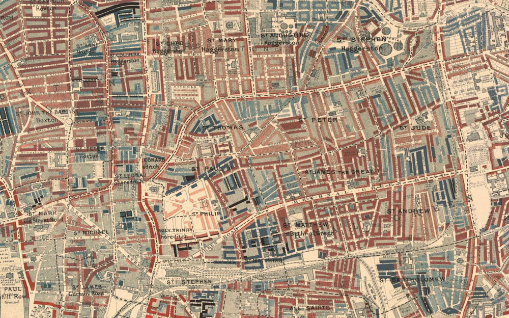
(Image: Wellcome Trust, Creative Commons)
Created by Charles Booth in 1889. He was a London-based businessman who believed that estimates of poverty in London were overinflated. He set out to prove analysts wrong by creating this map and instead, proved just the opposite: that as many as one third of Londoners lived in poverty.
The idea of plotting health and inequality across a map would prove invaluable in understanding social welfare and thus addressing it accordingly. yeah ! say that again !
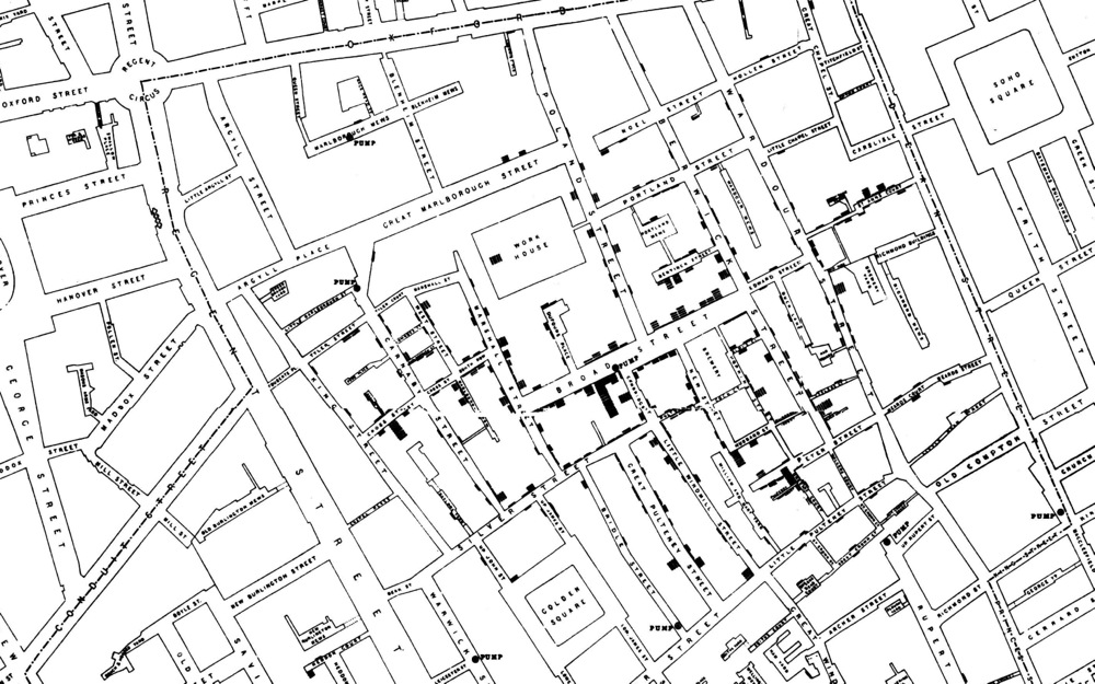
8. BROAD STREET CHOLERA MAP, 1854
.jpg)
(Image: Public Domain)
When cholera broke out in London in 1854, physician John Snow fought against the popular opinion that it was caused by “bad air”. He thought otherwise, and so started plotting dots representing known cases of cholera on a map of London.
His method proved that it wasn’t bad air at all, but bad water from a street pump. The connection might sound trivial, but in reality Snow is responsible for saving millions of lives. His work was a major event in the history of public health and is regarded as the founding event of the science of epidemiology. They must have been serious of whirlwind prior to this outbreak I suppose...well what century was it again ?
9. ORDNANCE SURVEY (OS) MAPS, 1791 – PRESENT DAY
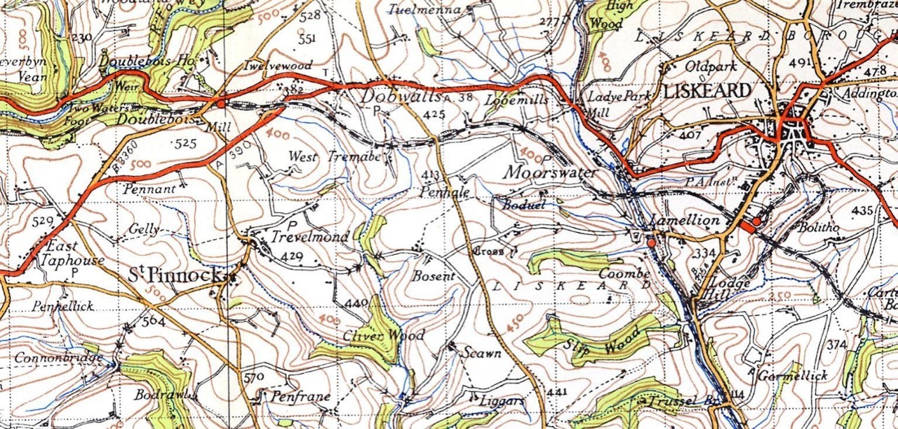
(Image: Public Domain)
Actually, these maps are some of the best and most important in the history of the world. The processes of trigonometry, geometry and triangulation used in their creation were responsible for the advancement of cartography, navigation and discovery over the last 200 years
10. PETERS WORLD MAP, 1973
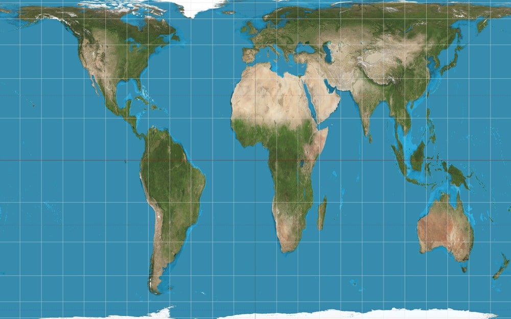
(Image: Strebe, Creative Commons)
In 1973, filmmaker Arno Peters presented a world map based on the work of 19thcentury clergyman James Gall.
This projection uses a mathematical formula to project areas of equal size on the globe as equally sized on the map. For example, unlike the Mercator projection, Africa is represented at its true size: 14 times larger than Greenland (just compare it to the map below).
11. GOOGLE MAPS, 2005 – PRESENT DAY
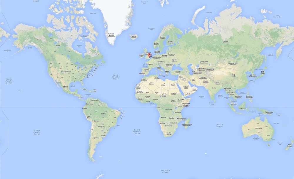
(Image: Google Maps)
Google didn’t just change how we see the world with their online mapping service, they likely changed the world itself.
Welcome back.
Comments
Post a Comment